
西牛镇 topographic map
Interactive map
Click on the map to display elevation.
About this map
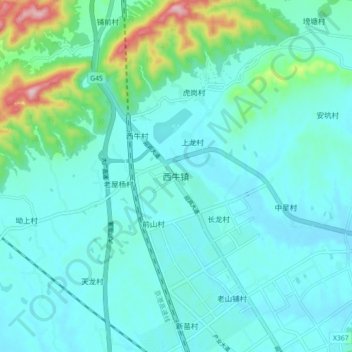
Name: 西牛镇 topographic map, elevation, terrain.
Location: 西牛镇, 信丰县, 赣州市, 江西省, 中国 (25.41828 114.84407 25.49828 114.92407)
Average elevation: 646 ft
Minimum elevation: 486 ft
Maximum elevation: 1,480 ft
Other topographic maps
Click on a map to view its topography, its elevation and its terrain.