Geolocate

Windsor topographic map

Click on the map to display elevation.

About this map

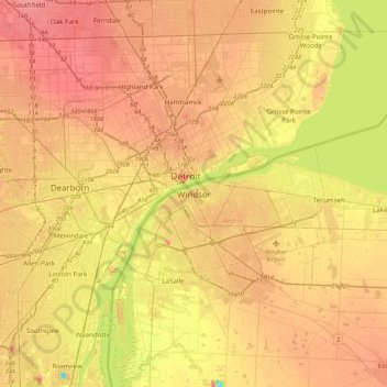
Name: Windsor topographic map, elevation, terrain.

Location: Windsor, Southwestern Ontario, Ontario, N9A 3A8, Canada (42.15674 -83.19734 42.47674 -82.87734)

Average elevation: 607 ft

Minimum elevation: 456 ft

Maximum elevation: 712 ft

Other topographic maps

Click on a map to view its topography, its elevation and its terrain.

Peche Island

Canada > Ontario > Windsor > Windsor

Average elevation: 574 ft

Gear up for your next adventure:

🔋Rechargeable Batteries - Power up your outdoor devices
🛡️Insect Repellent - Protection against bugs during outdoor activities
🪶Camp Gear Gift Set - Perfect gift bundle for outdoor fans
🪵Folding Camp Saw - Compact saw for wood and campsite work
🌐World Map Poster - Decorative world maps with topographic info

As an Amazon Associate, this site earns from qualifying purchases at no extra cost to you.