Geolocate

Aretsried topographic map

Click on the map to display elevation.

About this map

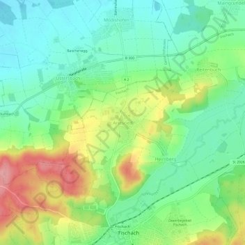
Name: Aretsried topographic map, elevation, terrain.

Location: Aretsried, Fischach, Landkreis Augsburg, Bayern, 86514, Deutschland (48.28822 10.63397 48.32822 10.67397)

Average elevation: 1,650 ft

Minimum elevation: 1,509 ft

Maximum elevation: 1,900 ft

Other topographic maps

Click on a map to view its topography, its elevation and its terrain.

86850

Deutschland > Bayern > Landkreis Augsburg > Fischach > Wollmetshofen

Average elevation: 1,719 ft

Gear up for your next adventure:

🧦Merino Wool Socks - Moisture-wicking, blister-preventing socks for long treks
📖Nature Tracking Books - Learn to track wildlife and terrain
📱Solar Portable Charger - Solar power bank for charging devices off‑grid
🔊Portable Camp Speaker - Music and alerts at camp
👟Trail Running Shoes - Lightweight shoes for trail runners

As an Amazon Associate, this site earns from qualifying purchases at no extra cost to you.