
Make a donation
Gear up for your next adventure:
As an Amazon Associate, this site earns from qualifying purchases at no extra cost to you.
Sacsayhuamán topographic map
Click on the map to display elevation.
Make a donation
Gear up for your next adventure:
As an Amazon Associate, this site earns from qualifying purchases at no extra cost to you.
Sacsayhuamán
Sacsayhuamán (/ˈsæksaɪˌwʌmən/ SACK-sy-wuh-mən; Spanish pronunciation: [saksajwaˈman]) or Saksaywaman (from Quechua Saksay waman pukara, pronounced [ˈsaksaj ˈwaman], lit. 'fortress of the royal falcon or hawk') is a citadel on the northern outskirts of the city of Cusco, Peru, the historic capital of the Inca Empire. The site is at an altitude of 3,701 metres (12,142 ft).
Make a donation
Gear up for your next adventure:
As an Amazon Associate, this site earns from qualifying purchases at no extra cost to you.
About this map
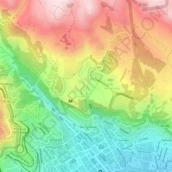
Name: Sacsayhuamán topographic map, elevation, terrain.
Average elevation: 11,739 ft
Minimum elevation: 11,066 ft
Maximum elevation: 12,428 ft
Make a donation
Gear up for your next adventure:
As an Amazon Associate, this site earns from qualifying purchases at no extra cost to you.