
Thank you for supporting this site ❤️
Make a donation
Make a donation
Gear up for your next adventure:
As an Amazon Associate, this site earns from qualifying purchases at no extra cost to you.
Nahuinlla topographic map
Click on the map to display elevation.
Thank you for supporting this site ❤️
Make a donation
Make a donation
Gear up for your next adventure:
As an Amazon Associate, this site earns from qualifying purchases at no extra cost to you.
About this map
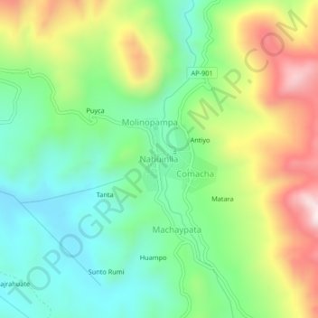
Name: Nahuinlla topographic map, elevation, terrain.
Location: Nahuinlla, Coyllurqui, Cotabambas, Apurímac, Perú (-13.97944 -72.41687 -13.93944 -72.37687)
Average elevation: 13,340 ft
Minimum elevation: 12,615 ft
Maximum elevation: 14,593 ft
Thank you for supporting this site ❤️
Make a donation
Make a donation
Gear up for your next adventure:
As an Amazon Associate, this site earns from qualifying purchases at no extra cost to you.