
Thank you for supporting this site ❤️
Make a donation
Make a donation
Gear up for your next adventure:
As an Amazon Associate, this site earns from qualifying purchases at no extra cost to you.
Tigignas topographic map
Click on the map to display elevation.
Thank you for supporting this site ❤️
Make a donation
Make a donation
Gear up for your next adventure:
As an Amazon Associate, this site earns from qualifying purchases at no extra cost to you.
About this map
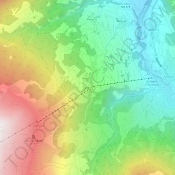
Name: Tigignas topographic map, elevation, terrain.
Location: Tigignas, Surses, Albula, Grisons, 7464, Suisse (46.57440 9.55036 46.61440 9.59036)
Average elevation: 5,308 ft
Minimum elevation: 3,681 ft
Maximum elevation: 7,779 ft
Thank you for supporting this site ❤️
Make a donation
Make a donation
Gear up for your next adventure:
As an Amazon Associate, this site earns from qualifying purchases at no extra cost to you.