Geolocate

Barun topographic map

Click on the map to display elevation.

About this map

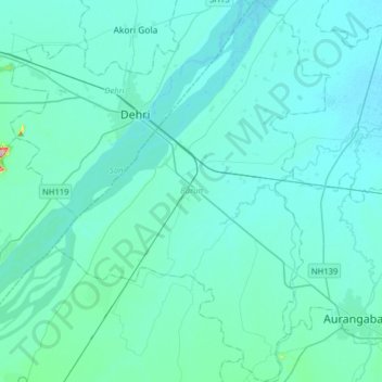
Name: Barun topographic map, elevation, terrain.

Location: Barun, Aurangabad District, Bihar, India (24.70559 84.12294 24.99387 84.35251)

Average elevation: 354 ft

Minimum elevation: 295 ft

Maximum elevation: 1,112 ft

Gear up for your next adventure:

🪶Fire Starter Kit - Reliable fire starter for survival and camping
🧯Emergency Survival Kit - All‑in‑one survival essentials for the backcountry
📱Heavy-Duty Phone Cases - Drop-proof and waterproof protection for outdoor navigation
🔋Rechargeable Batteries - Power up your outdoor devices
🧴Hand Sanitizer - Keep hands clean while hiking

As an Amazon Associate, this site earns from qualifying purchases at no extra cost to you.