
Thank you for supporting this site ❤️
Make a donation
Make a donation
Gear up for your next adventure:
As an Amazon Associate, this site earns from qualifying purchases at no extra cost to you.
Verigo topographic map
Click on the map to display elevation.
Thank you for supporting this site ❤️
Make a donation
Make a donation
Gear up for your next adventure:
As an Amazon Associate, this site earns from qualifying purchases at no extra cost to you.
About this map
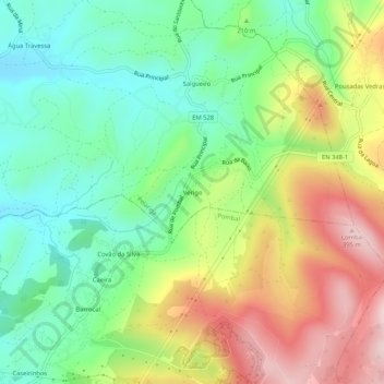
Name: Verigo topographic map, elevation, terrain.
Location: Verigo, Pelariga, Pombal, Leiria, 3100-319, Portugal (39.92276 -8.60265 39.96276 -8.56265)
Average elevation: 659 ft
Minimum elevation: 230 ft
Maximum elevation: 1,312 ft
Thank you for supporting this site ❤️
Make a donation
Make a donation
Gear up for your next adventure:
As an Amazon Associate, this site earns from qualifying purchases at no extra cost to you.