
Thank you for supporting this site ❤️
Make a donation
Make a donation
Gear up for your next adventure:
As an Amazon Associate, this site earns from qualifying purchases at no extra cost to you.
Tlemcen topographic map
Click on the map to display elevation.
Thank you for supporting this site ❤️
Make a donation
Make a donation
Gear up for your next adventure:
As an Amazon Associate, this site earns from qualifying purchases at no extra cost to you.
About this map
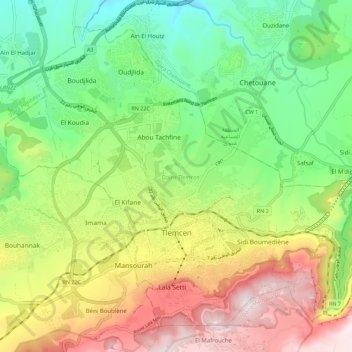
Name: Tlemcen topographic map, elevation, terrain.
Location: Tlemcen, Tlemcen District, Tlemcen, 13000, Algeria (34.85750 -1.37068 34.93523 -1.25946)
Average elevation: 2,385 ft
Minimum elevation: 1,276 ft
Maximum elevation: 4,019 ft
Thank you for supporting this site ❤️
Make a donation
Make a donation
Gear up for your next adventure:
As an Amazon Associate, this site earns from qualifying purchases at no extra cost to you.