Geolocate

Manali topographic map

Click on the map to display elevation.

About this map

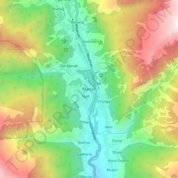
Name: Manali topographic map, elevation, terrain.

Location: Manali, Kullu, Himachal Pradesh, 175131, India (32.20546 77.14729 32.28546 77.22729)

Average elevation: 8,550 ft

Minimum elevation: 5,650 ft

Maximum elevation: 13,189 ft

Gear up for your next adventure:

🖼️Topo Map Wall Art - Decorative topographic prints of famous peaks and regions
🦺Reflective Outdoor Gear - Safety gear for low‑light conditions
🦶Carbon Trekking Poles - Reduce knee impact on steep descents with ultra-light poles
🕶️Glacier Sunglasses - Side shields to protect eyes from high-altitude snow glare
🛠️Outdoor Gear Repair Kit - Essential tools to fix gear on the trail

As an Amazon Associate, this site earns from qualifying purchases at no extra cost to you.