
Make a donation
Gear up for your next adventure:
As an Amazon Associate, this site earns from qualifying purchases at no extra cost to you.
Tin Liu topographic map
Click on the map to display elevation.
Make a donation
Gear up for your next adventure:
As an Amazon Associate, this site earns from qualifying purchases at no extra cost to you.
About this map
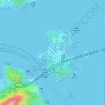
Name: Tin Liu topographic map, elevation, terrain.
Location: Tin Liu, New Territories, Hong Kong, China (22.34971 114.05785 22.35001 114.05851)
Average elevation: 36 ft
Minimum elevation: -3 ft
Maximum elevation: 656 ft
Make a donation
Gear up for your next adventure:
As an Amazon Associate, this site earns from qualifying purchases at no extra cost to you.
Other topographic maps
Click on a map to view its topography, its elevation and its terrain.
Victoria Peak
China > Hong Kong > Hong Kong Island
Victoria Peak is a hill on the western half of Hong Kong Island. It is also known as Mount Austin, and locally as The Peak only generally. With an elevation of 552 metres (1,811 ft), it is the tallest hill on Hong Kong Island, and the 29th tallest in the territory of Hong Kong. It is a major tourist attraction…
Average elevation: 686 ft
Make a donation
Gear up for your next adventure:
As an Amazon Associate, this site earns from qualifying purchases at no extra cost to you.
Tai Mo Shan
China > Hong Kong > Tsuen Wan District
Tai Mo Shan is the highest peak in Hong Kong, with an elevation of 957 metres (3,140 ft) above the Hong Kong Principal Datum [zh], or around 956 metres (3,136 ft) above mean sea level. It is located at approximately the geographical centre of the New Territories.
Average elevation: 1,969 ft
Make a donation
Gear up for your next adventure:
As an Amazon Associate, this site earns from qualifying purchases at no extra cost to you.
Make a donation
Gear up for your next adventure:
As an Amazon Associate, this site earns from qualifying purchases at no extra cost to you.
Make a donation
Gear up for your next adventure:
As an Amazon Associate, this site earns from qualifying purchases at no extra cost to you.
Basalt Island
China > Hong Kong > Sai Kung District
Basalt Island is located south of Town Island and Wang Chau, east of Bluff Island and north of the Ninepin Group. Its highest elevation is 174 m. Notably, despite its name is “Basalt Island”, the rocks that forms the island are indeed rhyolitic tuff.
Average elevation: 20 ft
Make a donation
Gear up for your next adventure:
As an Amazon Associate, this site earns from qualifying purchases at no extra cost to you.
Make a donation
Gear up for your next adventure:
As an Amazon Associate, this site earns from qualifying purchases at no extra cost to you.
Make a donation
Gear up for your next adventure:
As an Amazon Associate, this site earns from qualifying purchases at no extra cost to you.
Make a donation
Gear up for your next adventure:
As an Amazon Associate, this site earns from qualifying purchases at no extra cost to you.
Make a donation
Gear up for your next adventure:
As an Amazon Associate, this site earns from qualifying purchases at no extra cost to you.
Make a donation
Gear up for your next adventure:
As an Amazon Associate, this site earns from qualifying purchases at no extra cost to you.
Ma Wan
China > Hong Kong > Tsuen Wan District > Wang Lung Mei > Ma Wan Main Street Village
Average elevation: 39 ft
Make a donation
Gear up for your next adventure:
As an Amazon Associate, this site earns from qualifying purchases at no extra cost to you.
Lantau Peak
China > Hong Kong > Islands District
Lantau Peak is located in central Lantau Island, with an elevation of 934 meters above sea level (23 metres shorter than Tai Mo Shan, Hong Kong's highest peak). Under the Köppen climate classification, Lantau Peak features a subtropical highland climate. Due to its elevation, strong winds and fog occur…
Average elevation: 1,385 ft
Make a donation
Gear up for your next adventure:
As an Amazon Associate, this site earns from qualifying purchases at no extra cost to you.
Make a donation
Gear up for your next adventure:
As an Amazon Associate, this site earns from qualifying purchases at no extra cost to you.
Make a donation
Gear up for your next adventure:
As an Amazon Associate, this site earns from qualifying purchases at no extra cost to you.
Make a donation
Gear up for your next adventure:
As an Amazon Associate, this site earns from qualifying purchases at no extra cost to you.
Needle Hill
China > Hong Kong > Sha Tin District
Needle Hill or Cham Shan (Chinese: 針山) is a mountain in New Territories, Hong Kong. It has an altitude of 532 m. This is a part of a popular hiking route including Grassy Hill and Tai Mo Shan. The mountain got its name due to the resemblance of a needle by its peak.
Average elevation: 768 ft
Make a donation
Gear up for your next adventure:
As an Amazon Associate, this site earns from qualifying purchases at no extra cost to you.
Make a donation
Gear up for your next adventure:
As an Amazon Associate, this site earns from qualifying purchases at no extra cost to you.
Make a donation
Gear up for your next adventure:
As an Amazon Associate, this site earns from qualifying purchases at no extra cost to you.
Tsing Yi
China > Hong Kong > Kwai Tsing District > Tai Wong Ha Resite Village
Average elevation: 112 ft
Make a donation
Gear up for your next adventure:
As an Amazon Associate, this site earns from qualifying purchases at no extra cost to you.
Make a donation
Gear up for your next adventure:
As an Amazon Associate, this site earns from qualifying purchases at no extra cost to you.
Make a donation
Gear up for your next adventure:
As an Amazon Associate, this site earns from qualifying purchases at no extra cost to you.
Kwai Chung Tai Hang Mei Tsuen
China > Hong Kong > Kwai Tsing District > Kwai Chung
Average elevation: 577 ft
Make a donation
Gear up for your next adventure:
As an Amazon Associate, this site earns from qualifying purchases at no extra cost to you.
Sunset Peak
Sunset Peak is only accessible by foot. It is located on section 2 of the 70 km (43 mi) long Lantau Trail. Section 2 is 6.5 km long and goes from Nam Shan Campsite west of Mui Wo on South Lantau Road (elevation about 120 m), to Pak Kung Au, another campsite on the Tung Chung Road (elevation about 340 m). Both…
Average elevation: 1,348 ft
Make a donation
Gear up for your next adventure:
As an Amazon Associate, this site earns from qualifying purchases at no extra cost to you.
Make a donation
Gear up for your next adventure:
As an Amazon Associate, this site earns from qualifying purchases at no extra cost to you.
Make a donation
Gear up for your next adventure:
As an Amazon Associate, this site earns from qualifying purchases at no extra cost to you.