
Thank you for supporting this site ❤️
Make a donation
Make a donation
Gear up for your next adventure:
As an Amazon Associate, this site earns from qualifying purchases at no extra cost to you.
Ropli topographic map
Click on the map to display elevation.
Thank you for supporting this site ❤️
Make a donation
Make a donation
Gear up for your next adventure:
As an Amazon Associate, this site earns from qualifying purchases at no extra cost to you.
About this map
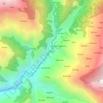
Name: Ropli topographic map, elevation, terrain.
Location: Ropli, Ani, Kullu, Himachal Pradesh, 175038, India (31.42326 77.40796 31.46326 77.44796)
Average elevation: 5,492 ft
Minimum elevation: 3,563 ft
Maximum elevation: 7,936 ft
Thank you for supporting this site ❤️
Make a donation
Make a donation
Gear up for your next adventure:
As an Amazon Associate, this site earns from qualifying purchases at no extra cost to you.