Geolocate
👉 Easily get elevation data in JSON, GeoTIFF and KML formats using Elevation API
Thank you for supporting this site ❤️
Make a donation

Palestina topographic map

Click on the map to display elevation.

About this map

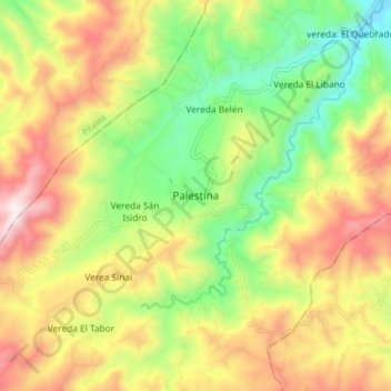
Name: Palestina topographic map, elevation, terrain.

Location: Palestina, Sur, Huila, Colombia (1.68295 -76.17119 1.76295 -76.09119)

Average elevation: 5,486 ft

Minimum elevation: 4,311 ft

Maximum elevation: 6,867 ft

Gear up for your next adventure:

🔦LED Headlamp - Bright and durable LED headlamp for night navigation
🧢Outdoor Hiking Hat - Sun protection hat for outdoor explorers
🧯Portable Fire Pit - Compact fire pit for camping spots
🧭Map Reading Tools - Tools and kits for map navigation
🚗GPS Dash Cams - Record your scenic drives through mountain passes and canyons

As an Amazon Associate, this site earns from qualifying purchases at no extra cost to you.