
Duke of York Islands topographic map
Interactive map
Click on the map to display elevation.
About this map
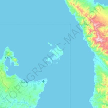
Name: Duke of York Islands topographic map, elevation, terrain.
Average elevation: 381 ft
Minimum elevation: 0 ft
Maximum elevation: 5,843 ft
Other topographic maps
Click on a map to view its topography, its elevation and its terrain.
Mualim
Papua New Guinea > East New Britain
Mualim, East New Britain, Islands Region, Papua New Guinea
Average elevation: 10 ft
Mauna
Papua New Guinea > East New Britain
Mauna, East New Britain, Islands Region, Papua New Guinea
Average elevation: 56 ft
Rabaul
Papua New Guinea > East New Britain
Rabaul, East New Britain, Islands Region, Papua New Guinea
Average elevation: 157 ft
Tokua Plantation
Papua New Guinea > East New Britain > Tokua Plantation
Tokua Plantation, East New Britain, Islands Region, Papua New Guinea
Average elevation: 52 ft