
Make a donation
Gear up for your next adventure:
As an Amazon Associate, this site earns from qualifying purchases at no extra cost to you.
Panix topographic map
Click on the map to display elevation.
Make a donation
Gear up for your next adventure:
As an Amazon Associate, this site earns from qualifying purchases at no extra cost to you.
Panix
Der Fernwanderweg Senda Sursilvana führt als touristisch markierter Höhenweg von Breil/Brigels-Waltensburg/Vuorz-Andiast durch Panix und weiter entlang des jungen Rheins in Richtung Chur.
Make a donation
Gear up for your next adventure:
As an Amazon Associate, this site earns from qualifying purchases at no extra cost to you.
About this map
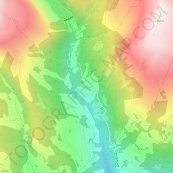
Name: Panix topographic map, elevation, terrain.
Location: Panix, Ilanz/Glion, Surselva, Graubünden, 7156, Schweiz (46.78954 9.09596 46.82954 9.13596)
Average elevation: 5,361 ft
Minimum elevation: 3,261 ft
Maximum elevation: 7,690 ft
Make a donation
Gear up for your next adventure:
As an Amazon Associate, this site earns from qualifying purchases at no extra cost to you.