Geolocate

Snetterton topographic map

Click on the map to display elevation.

About this map

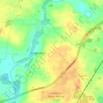
Name: Snetterton topographic map, elevation, terrain.

Location: Snetterton, Breckland District, Norfolk, England, United Kingdom (52.46222 0.91376 52.50321 0.96351)

Average elevation: 112 ft

Minimum elevation: 56 ft

Maximum elevation: 161 ft

Gear up for your next adventure:

🚪Portable Camp Chair - Foldable chair for comfort at camp
🪶Wildlife Field Guides - Learn animal tracking and species ID
🧥Men's Rain Shells - Premium waterproof and breathable jackets for mountain weather
🥾Men's Hiking Boots - Durable, waterproof footwear for rugged terrain and steep inclines
🛠️Backpacking Tool Kit - Essential toolkit for outdoor repairs

As an Amazon Associate, this site earns from qualifying purchases at no extra cost to you.