Geolocate

Bella Coola topographic map

Click on the map to display elevation.

Bella Coola

There is a 454 km mostly paved road connection by Highway 20 to Williams Lake. The road was built in 1953 by local residents, and features a 15 km ascent from the Valley floor to the Chilcotin plateau, gaining 1600m in elevation to the summit at Heckman Pass, via a number of steep grades & switchbacks. The construction of this road was described in the books "Bella Coola" and "A Road Runs West".

Wikipedia (CC-BY-SA 3.0)

About this map

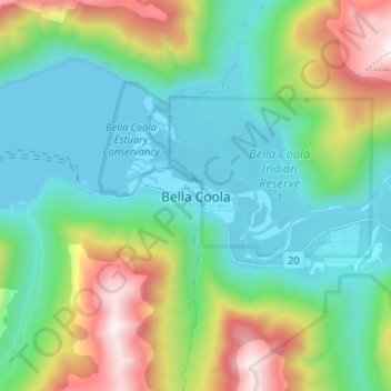
Name: Bella Coola topographic map, elevation, terrain.

Location: Bella Coola, Area E (West Bella Coola/Clayton Falls/Tallheo), Central Coast Regional District, British Columbia, V0T 1C0, Canada (52.33228 -126.79565 52.41228 -126.71565)

Average elevation: 1,434 ft

Minimum elevation: -3 ft

Maximum elevation: 5,279 ft

Gear up for your next adventure:

🚪Portable Camp Chair - Foldable chair for comfort at camp
🎁Geography Themed Gifts - Unique gift ideas for map lovers and geography enthusiasts
Backpacking Tents - Weight-optimized shelters for multi-day topographic surveys
🚑Emergency Bivvies - Heat-reflective sleeping bags for survival situations
📌Outdoor GPS Map App - Apps and devices for digital topographic navigation

As an Amazon Associate, this site earns from qualifying purchases at no extra cost to you.