
Thank you for supporting this site ❤️
Make a donation
Make a donation
Gear up for your next adventure:
As an Amazon Associate, this site earns from qualifying purchases at no extra cost to you.
Muristenis/Monastir topographic map
Click on the map to display elevation.
Thank you for supporting this site ❤️
Make a donation
Make a donation
Gear up for your next adventure:
As an Amazon Associate, this site earns from qualifying purchases at no extra cost to you.
About this map
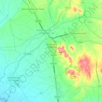
Name: Muristenis/Monastir topographic map, elevation, terrain.
Location: Muristenis/Monastir, Casteddu/Cagliari, Sardinia, 09023, Italy (39.34054 9.00275 39.42051 9.08496)
Average elevation: 262 ft
Minimum elevation: 92 ft
Maximum elevation: 712 ft
Thank you for supporting this site ❤️
Make a donation
Make a donation
Gear up for your next adventure:
As an Amazon Associate, this site earns from qualifying purchases at no extra cost to you.