Geolocate

Malahide topographic map

Click on the map to display elevation.

About this map

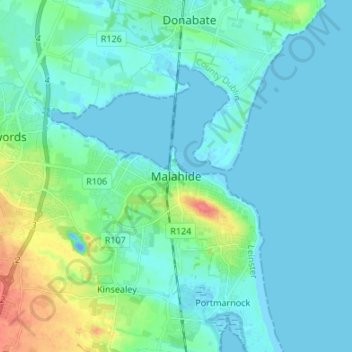
Name: Malahide topographic map, elevation, terrain.

Location: Malahide, Fingal, County Dublin, Leinster, K36 HN84, Ireland (53.41084 -6.19367 53.49084 -6.11367)

Average elevation: 33 ft

Minimum elevation: -62 ft

Maximum elevation: 184 ft

Other topographic maps

Click on a map to view its topography, its elevation and its terrain.

Malahide (Union) 1900

Ireland > County Dublin > Malahide

Average elevation: 39 ft

Gear up for your next adventure:

🧥Waterproof Jacket for Hiking - Breathable and rugged rain jacket for outdoor excursions
🧦Hiking Socks - Comfortable socks to prevent blisters on long hikes
🏥Hiking First Aid Kits - Comprehensive medical kits for remote trail injuries
🏕️Family Camping Gear - Essentials for group camping trips
📦Gear Storage Bags - Organize and protect outdoor equipment

As an Amazon Associate, this site earns from qualifying purchases at no extra cost to you.