
Markleeville topographic map
Click on the map to display elevation.
Markleeville
Markleeville hosts an annual bicycle ride called the Death Ride - Tour of the California Alps. The route goes over five passes for a total distance of 129 miles and over 15,000 feet of elevation gain. In 2010 3,500 riders participated and 2,417 completed the full course of 5 mountain passes.
About this map
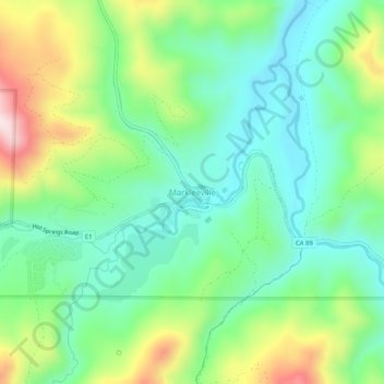
Name: Markleeville topographic map, elevation, terrain.
Location: Markleeville, Alpine County, California, United States (38.67492 -119.80020 38.71492 -119.76020)
Average elevation: 5,866 ft
Minimum elevation: 5,410 ft
Maximum elevation: 6,818 ft
Alpine County trails, hiking, mountain biking, running and outdoor activities
Other topographic maps
Click on a map to view its topography, its elevation and its terrain.
Markleeville
United States > California > Alpine County
Markleeville hosts an annual bicycle ride called the Death Ride - Tour of the California Alps. The route goes over five mountain passes for a total distance of 129 miles and over 15,000 feet of elevation gain. In 2010, 3,500 riders participated and 2,417 completed the full course.
Average elevation: 7,136 ft