
Make a donation
Gear up for your next adventure:
As an Amazon Associate, this site earns from qualifying purchases at no extra cost to you.
Katla topographic map
Click on the map to display elevation.
Make a donation
Gear up for your next adventure:
As an Amazon Associate, this site earns from qualifying purchases at no extra cost to you.
Katla
Le Katla est constitué d'une montagne couronnée par une caldeira, appelée Kötlugjá, de quatorze kilomètres de longueur pour dix kilomètres de largeur orientée dans le sens nord-ouest-sud-est. Le point culminant du Katla avec 1 512 mètres d'altitude est constitué d'un des rebords de cette caldeira. Cette dépression de 750 mètres de profondeur est occupée par une calotte glaciaire, le Mýrdalsjökull, qui déborde de la caldeira en de nombreux glaciers de vallée sur ses flancs Ouest et Sud et en deux grands lobes glaciaire sur ses flancs Est et Nord.
Make a donation
Gear up for your next adventure:
As an Amazon Associate, this site earns from qualifying purchases at no extra cost to you.
About this map
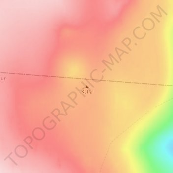
Name: Katla topographic map, elevation, terrain.
Location: Katla, Mýrdalshreppur, Suðurland, Islande (63.62994 -19.05002 63.63004 -19.04992)
Average elevation: 4,026 ft
Minimum elevation: 3,533 ft
Maximum elevation: 4,216 ft
Make a donation
Gear up for your next adventure:
As an Amazon Associate, this site earns from qualifying purchases at no extra cost to you.
Other topographic maps
Click on a map to view its topography, its elevation and its terrain.