Geolocate

Nagar topographic map

Click on the map to display elevation.

Nagar

Brij Nagar is located at 27°25′29″N 77°05′58″E / 27.4247°N 77.09945°E / 27.4247; 77.09945. It has an average elevation of 201 metres (662 feet) from the sea level.

Wikipedia (CC-BY-SA 3.0)

About this map

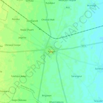
Name: Nagar topographic map, elevation, terrain.

Location: Nagar, Nagar Tehsil, Bharatpur District, Rajasthan, 321205, India (27.38166 77.06041 27.46166 77.14041)

Average elevation: 663 ft

Minimum elevation: 643 ft

Maximum elevation: 686 ft

Gear up for your next adventure:

🥤Water Filter Bottle - All‑in‑one filter bottle for safe hydration
🧢Sun Protection Hats - Wide-brimmed and UPF-rated hats for high-altitude sun safety
🔊Portable Camp Speaker - Music and alerts at camp
🥄Camping Utensil Set - Lightweight utensils for outdoor meals
🎒Day Hiking Backpack - Lightweight backpack perfect for day trips and outdoor adventures

As an Amazon Associate, this site earns from qualifying purchases at no extra cost to you.