
Thank you for supporting this site ❤️
Make a donation
Make a donation
Gear up for your next adventure:
As an Amazon Associate, this site earns from qualifying purchases at no extra cost to you.
Korla topographic map
Click on the map to display elevation.
Thank you for supporting this site ❤️
Make a donation
Make a donation
Gear up for your next adventure:
As an Amazon Associate, this site earns from qualifying purchases at no extra cost to you.
About this map
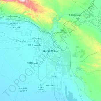
Name: Korla topographic map, elevation, terrain.
Location: Korla, Korla City, Bayingolin, Xinjiang, 841000, China (41.56387 86.01354 41.88387 86.33354)
Average elevation: 3,392 ft
Minimum elevation: 2,946 ft
Maximum elevation: 6,650 ft
Thank you for supporting this site ❤️
Make a donation
Make a donation
Gear up for your next adventure:
As an Amazon Associate, this site earns from qualifying purchases at no extra cost to you.