
Thank you for supporting this site ❤️
Make a donation
Make a donation
Gear up for your next adventure:
As an Amazon Associate, this site earns from qualifying purchases at no extra cost to you.
Huandoy topographic map
Click on the map to display elevation.
Thank you for supporting this site ❤️
Make a donation
Make a donation
Gear up for your next adventure:
As an Amazon Associate, this site earns from qualifying purchases at no extra cost to you.
About this map
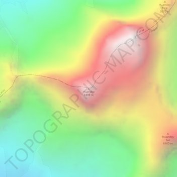
Name: Huandoy topographic map, elevation, terrain.
Location: Huandoy, Yungay, Áncash, Perú (-9.03492 -77.66987 -9.03482 -77.66977)
Average elevation: 18,182 ft
Minimum elevation: 15,692 ft
Maximum elevation: 20,902 ft
Thank you for supporting this site ❤️
Make a donation
Make a donation
Gear up for your next adventure:
As an Amazon Associate, this site earns from qualifying purchases at no extra cost to you.