
Serengeti National Park topographic map
Interactive map
Click on the map to display elevation.
About this map
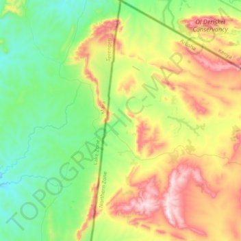
Name: Serengeti National Park topographic map, elevation, terrain.
Location: Serengeti National Park, C12, Narok, Kenya (-2.00135 35.21928 -1.68655 35.25748)
Average elevation: 6,076 ft
Minimum elevation: 5,272 ft
Maximum elevation: 7,566 ft
Other topographic maps
Click on a map to view its topography, its elevation and its terrain.