Kenya topographic maps
Click on a map to view its topography, its elevation and its terrain.


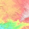
Isiolo
The local topography is arid or semi-arid low plains. Ewaso Nyiro River flows through the county and partly bounds it. It borders Marsabit County to the north, Wajir County to the east, Garissa and Tana River counties to the south east, Meru County to the south, Laikipia County to the south west and Samburu…
Average elevation: 1,529 ft
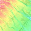
Elgeyo-Marakwet County
The Kerio River binds the county on the eastern side. From its alluvial plain the topography gradually rises towards the west. The Elgeyo Escarpment stands out distinctly and causes elevation differences of up to 1,500 m. In the northern and southern part of the county the topography is rugged, giving way to…
Average elevation: 5,676 ft



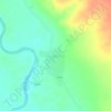
Taita–Taveta
The population of Taita-Taveta county was 340,671 persons according to the 2019 national census, with population densities ranging from 14 persons per km2 to more than 117 persons per km2. This is due to the varied rainfall and terrain with the lower zones receiving an average 440 mm of rain per annum and the…
Average elevation: 2,280 ft

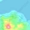
Kakamega
Kakamega is 52 km north of Kisumu, the tenth largest city in Kenya and considered the heart of Luhya land. The average elevation of Kakamega is 1,535 metres.
Average elevation: 5,030 ft





Lake Bogoria
There are contradictions regarding its altitude. Unesco's Ramsar gives 963 m (3,159 ft). More precise — and more prudent —, Renaut & Owen 1991 give c. 990 m as of August 1977, but also indicate that the lake's level fluctuates seasonally by 50 to 100 cm; and that it can vary by several meters for short…
Average elevation: 4,324 ft