
Thank you for supporting this site ❤️
Make a donation
Make a donation
Gear up for your next adventure:
As an Amazon Associate, this site earns from qualifying purchases at no extra cost to you.
Cavagliola topographic map
Click on the map to display elevation.
Thank you for supporting this site ❤️
Make a donation
Make a donation
Gear up for your next adventure:
As an Amazon Associate, this site earns from qualifying purchases at no extra cost to you.
About this map
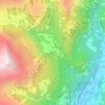
Name: Cavagliola topographic map, elevation, terrain.
Location: Cavagliola, Poschiavo, Bernina, Grisons, 7741, Switzerland (46.34128 10.02235 46.38128 10.06235)
Average elevation: 5,925 ft
Minimum elevation: 3,501 ft
Maximum elevation: 9,154 ft
Thank you for supporting this site ❤️
Make a donation
Make a donation
Gear up for your next adventure:
As an Amazon Associate, this site earns from qualifying purchases at no extra cost to you.