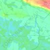
Gunja topographic map
Click on the map to display elevation.
About this map

Name: Gunja topographic map, elevation, terrain.
Location: Gunja, Općina Gunja, Vukovar-Srijem County, 32260, Croatia (44.86793 18.80644 44.90793 18.84644)
Average elevation: 276 ft
Minimum elevation: 256 ft
Maximum elevation: 328 ft
Other topographic maps
Click on a map to view its topography, its elevation and its terrain.


Vukovar
Croatia > Vukovar-Srijem County
Vukovar is located 20 km (12 mi) northeast of Vinkovci and 36 km (22 mi) southeast of Osijek, with an elevation of 108 m (354 ft). Vukovar is located on the main road D2 Osijek—Vukovar—Ilok and on the Vinkovci—Vukovar railway (and road D55).
Average elevation: 308 ft
Vinkovci
Croatia > Vukovar-Srijem County
Vinkovci is located in the eastern part of the Slavonia region, 19 km (12 mi) southwest of Vukovar, 24 km (15 mi) north of Županja and 43 km (27 mi) south of Osijek. The city lies in a flatland on the Bosut river, at an elevation of approx. 90 metres (300 ft), and has a mild continental climate. Vinkovci is…
Average elevation: 289 ft

Vukovar
Croatia > Vukovar-Srijem County
Vukovar is located 20 km (12 mi) northeast of Vinkovci and 36 km (22 mi) southeast of Osijek, with an elevation of 108 m (354 ft). Vukovar is located on the main road D2 Osijek—Vukovar—Ilok and on the Vinkovci—Vukovar railway (and road D55).
Average elevation: 308 ft

Vukovar
Croatia > Vukovar-Srijem County
Vukovar is located 20 km (12 mi) northeast of Vinkovci and 36 km (22 mi) southeast of Osijek, with an elevation of 108 m (354 ft). Vukovar is located on the main road D2 Osijek—Vukovar—Ilok and on the Vinkovci—Vukovar railway (and road D55).
Average elevation: 308 ft


Vukovar
Croatia > Vukovar-Srijem County
Vukovar is located 20 km (12 mi) northeast of Vinkovci and 36 km (22 mi) southeast of Osijek, with an elevation of 108 m (354 ft). Vukovar is located on the main road D2 Osijek—Vukovar—Ilok and on the Vinkovci—Vukovar railway (and road D55).
Average elevation: 308 ft


Mjesni odbor "Mirkovci"
Croatia > Vukovar-Srijem County > Vinkovci
Mirkovci are bordering village between regions of Slavonia and Syrmia. Its elevation is 95 meters above the sea level. The village lies in a flatland north to the Bosut river. The village is connected with the rest of the country by the D46 state road connecting it with the town of Vinkovci and continuing into…
Average elevation: 289 ft