
Thank you for supporting this site ❤️
Make a donation
Make a donation
Gear up for your next adventure:
As an Amazon Associate, this site earns from qualifying purchases at no extra cost to you.
Homewood topographic map
Click on the map to display elevation.
Thank you for supporting this site ❤️
Make a donation
Make a donation
Gear up for your next adventure:
As an Amazon Associate, this site earns from qualifying purchases at no extra cost to you.
About this map
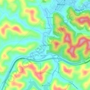
Name: Homewood topographic map, elevation, terrain.
Location: Homewood, Lewis County, West Virginia, 26452, United States (39.00037 -80.49648 39.04037 -80.45648)
Average elevation: 1,207 ft
Minimum elevation: 1,001 ft
Maximum elevation: 1,578 ft
Thank you for supporting this site ❤️
Make a donation
Make a donation
Gear up for your next adventure:
As an Amazon Associate, this site earns from qualifying purchases at no extra cost to you.