
Thank you for supporting this site ❤️
Make a donation
Make a donation
Gear up for your next adventure:
As an Amazon Associate, this site earns from qualifying purchases at no extra cost to you.
Ejulve topographic map
Click on the map to display elevation.
Thank you for supporting this site ❤️
Make a donation
Make a donation
Gear up for your next adventure:
As an Amazon Associate, this site earns from qualifying purchases at no extra cost to you.
About this map
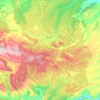
Name: Ejulve topographic map, elevation, terrain.
Location: Ejulve, Andorra-Sierra de Arcos, Teruel, Aragón, Spanje (40.68932 -0.62089 40.82580 -0.47751)
Average elevation: 3,770 ft
Minimum elevation: 2,411 ft
Maximum elevation: 5,276 ft
Thank you for supporting this site ❤️
Make a donation
Make a donation
Gear up for your next adventure:
As an Amazon Associate, this site earns from qualifying purchases at no extra cost to you.