Geolocate

Corire topographic map

Click on the map to display elevation.

About this map

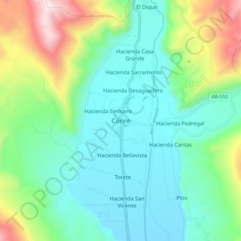
Name: Corire topographic map, elevation, terrain.

Location: Corire, Uraca, Castilla, Arequipa, Perú (-16.26292 -72.51106 -16.18292 -72.43106)

Average elevation: 2,178 ft

Minimum elevation: 1,270 ft

Maximum elevation: 4,731 ft

Gear up for your next adventure:

🔥Plasma Lighters - Windproof lighters that work in any weather condition
Backpacking Tent - Lightweight and durable tent for multi‑day hikes
👟Men's Trail Runners - Lightweight footwear for fast-paced exploration and light hiking
📦Gear Storage Bags - Organize and protect outdoor equipment
🧷Carabiner Set - Durable clips for gear attachment

As an Amazon Associate, this site earns from qualifying purchases at no extra cost to you.