
Dolle topographic map
Interactive map
Click on the map to display elevation.
About this map
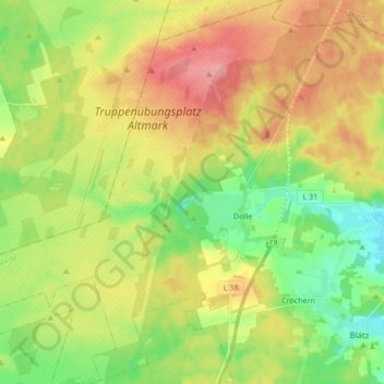
Name: Dolle topographic map, elevation, terrain.
Average elevation: 292 ft
Minimum elevation: 164 ft
Maximum elevation: 436 ft
Other topographic maps
Click on a map to view its topography, its elevation and its terrain.
Burgstall
Deutschland > Sachsen-Anhalt > Burgstall
Burgstall, Elbe-Heide, Börde, Sachsen-Anhalt, Deutschland
Average elevation: 217 ft