
Burgstall topographic map
Interactive map
Click on the map to display elevation.
About this map
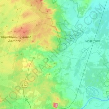
Name: Burgstall topographic map, elevation, terrain.
Location: Burgstall, Elbe-Heide, Börde, Sachsen-Anhalt, Deutschland (52.35021 11.49120 52.46976 11.80187)
Average elevation: 217 ft
Minimum elevation: 98 ft
Maximum elevation: 568 ft
Other topographic maps
Click on a map to view its topography, its elevation and its terrain.
Dolle
Deutschland > Sachsen-Anhalt > Burgstall
Dolle, Burgstall, Elbe-Heide, Börde, Sachsen-Anhalt, 39517, Deutschland
Average elevation: 292 ft