Geolocate

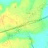
Burlington topographic map

Click on the map to display elevation.

About this map

Name: Burlington topographic map, elevation, terrain.

Location: Burlington, Milam County, Texas, United States (30.99489 -97.01691 31.03489 -96.97691)

Average elevation: 433 ft

Minimum elevation: 387 ft

Maximum elevation: 482 ft

Milam County trails, hiking, mountain biking, running and outdoor activities

Other topographic maps

Click on a map to view its topography, its elevation and its terrain.
Rockdale

United States > Texas > Milam County

Average elevation: 482 ft

Thorndale

United States > Texas > Milam County

Average elevation: 443 ft

Cameron

United States > Texas > Milam County

Average elevation: 381 ft

Cameron

United States > Texas > Milam County

Average elevation: 381 ft

Milano

United States > Texas > Milam County

Average elevation: 489 ft

Gear up for your next adventure:

🧥Men's Rain Shells - Premium waterproof and breathable jackets for mountain weather
🥾Men's Hiking Boots - Durable, waterproof footwear for rugged terrain and steep inclines
📖Nature Tracking Books - Learn to track wildlife and terrain
📡Handheld GPS Device - Reliable handheld GPS for outdoor navigation
📚Navigation Handbooks - Master the art of reading topographic maps and using a compass

As an Amazon Associate, this site earns from qualifying purchases at no extra cost to you.