Geolocate

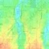
Simalingkar A topographic map

Click on the map to display elevation.

About this map

Name: Simalingkar A topographic map, elevation, terrain.

Location: Simalingkar A, Pancur Batu, Kabupaten Deli Serdang, North Sumatra, 20141, Indonesia (3.48002 98.61436 3.52002 98.65436)

Average elevation: 190 ft

Minimum elevation: 121 ft

Maximum elevation: 272 ft

Other topographic maps

Click on a map to view its topography, its elevation and its terrain.

Sunggal

Indonesia > North Sumatra > Kabupaten Deli Serdang

Average elevation: 115 ft

Gear up for your next adventure:

📶Vehicle Signal Boosters - Improve reception in rural areas while driving to trailheads
🧦Merino Wool Socks - Moisture-wicking, blister-preventing socks for long treks
🧭Orienteering Set - Complete compass and map reading kit
🪵Folding Camp Saw - Compact saw for wood and campsite work
🎒Trekking Poles - Sturdy poles for balance and stability on rough terrain

As an Amazon Associate, this site earns from qualifying purchases at no extra cost to you.