Geolocate

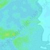
Kampung Aman topographic map

Click on the map to display elevation.

About this map

Name: Kampung Aman topographic map, elevation, terrain.

Location: Kampung Aman, Taiping, Larut, Matang and Selama, Perak, 34000, Malaysia (4.80979 100.72551 4.84979 100.76551)

Average elevation: 157 ft

Minimum elevation: 26 ft

Maximum elevation: 1,020 ft

Other topographic maps

Click on a map to view its topography, its elevation and its terrain.

Kampung Kurnia Jaya Tambahan

Malaysia > Perak > Taiping

Average elevation: 23 ft

Taiping Lake Gardens

Malaysia > Perak > Taiping > Kampung Peng Long

Average elevation: 161 ft

Sungai Reba

Malaysia > Perak > Taiping

Average elevation: 13 ft

Taiping Lake Gardens

Malaysia > Perak > Taiping > Kampung Peng Long

Average elevation: 161 ft

Larut River

Malaysia > Perak > Taiping

Average elevation: 10 ft

Sungai Jebong

Malaysia > Perak > Taiping

Average elevation: 151 ft

Gear up for your next adventure:

🦺Reflective Outdoor Gear - Safety gear for low‑light conditions
🪄Magnetic Compass - Accurate compass for navigation
🧭Hiking Compass - Precision compass for reliable navigation in the wilderness
🔦LED Headlamp - Bright and durable LED headlamp for night navigation
🔦Compact Flashlight - Reliable flashlight for emergencies

As an Amazon Associate, this site earns from qualifying purchases at no extra cost to you.