Geolocate

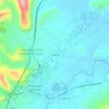
Nuoro topographic map

Click on the map to display elevation.

About this map

Name: Nuoro topographic map, elevation, terrain.

Location: Nuoro, Sardinia, 08100, Italy (40.25388 9.18302 40.41101 9.42608)

Average elevation: 1,631 ft

Minimum elevation: 246 ft

Maximum elevation: 4,764 ft

Other topographic maps

Click on a map to view its topography, its elevation and its terrain.
Biddanoa

Italy > Sardinia > Nuoro > Torpè

Average elevation: 295 ft

Cala Gonone

Italy > Sardinia > Nuoro

Average elevation: 463 ft

Montelongu

Italy > Sardinia > Nuoro > San Giovanni

Average elevation: 39 ft

Gorofai

Italy > Sardinia > Nuoro > Bitzi/Bitti

Average elevation: 1,939 ft

Cala Luna

Italy > Sardinia > Nuoro > Durgali/Dorgali

Average elevation: 249 ft

Pirastreri

Italy > Sardinia > Nuoro > Thiniscole/Siniscola

Average elevation: 194 ft

Cala Luna

Italy > Sardinia > Nuoro > Durgali/Dorgali

Average elevation: 249 ft

Gear up for your next adventure:

🔭Compact Binoculars - HD vision for scouting terrain and identifying distant landmarks
🪶Multi‑Purpose Knife - Useful blade for camp and trail
🎒Waterproof Dry Bags - Keep your electronics and maps dry inside your pack
🧷Carabiner Set - Durable clips for gear attachment
📦Dry Bags Set - Waterproof storage for electronics and clothes

As an Amazon Associate, this site earns from qualifying purchases at no extra cost to you.