Geolocate

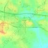
Lytham topographic map

Click on the map to display elevation.

About this map

Name: Lytham topographic map, elevation, terrain.

Location: Lytham, Borough of Fylde, Lancashire, England, FY8 5PB, United Kingdom (53.69882 -3.00516 53.77882 -2.92516)

Average elevation: 20 ft

Minimum elevation: 0 ft

Maximum elevation: 128 ft

Other topographic maps

Click on a map to view its topography, its elevation and its terrain.
Kirkham

United Kingdom > England > Lancashire > Borough of Fylde > Wesham

Average elevation: 72 ft

Staining

United Kingdom > England > Lancashire > Borough of Fylde

Average elevation: 43 ft

Gear up for your next adventure:

🛶Inflatable Kayak - Portable kayak for rivers, lakes, and expeditions
🩹Survival Bandages - High‑quality bandages for emergencies
🪶Camp Gear Gift Set - Perfect gift bundle for outdoor fans
🔦LED Headlamp - Bright and durable LED headlamp for night navigation
📦Gear Storage Bags - Organize and protect outdoor equipment

As an Amazon Associate, this site earns from qualifying purchases at no extra cost to you.