Geolocate

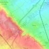
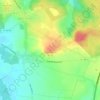
Teneur topographic map

Click on the map to display elevation.

About this map

Name: Teneur topographic map, elevation, terrain.

Location: Teneur, Arras, Pas-de-Calais, Hauts-de-France, Metropolitan France, 62134, France (50.43267 2.18844 50.46770 2.24612)

Average elevation: 289 ft

Minimum elevation: 141 ft

Maximum elevation: 443 ft

Other topographic maps

Click on a map to view its topography, its elevation and its terrain.

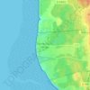
Panehem

France > Hauts-de-France > Pas-de-Calais > Samer

Average elevation: 230 ft

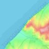
Cap Blanc Nez

France > Hauts-de-France > Pas-de-Calais > Escalles

Average elevation: 108 ft

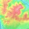
Noyelles

France > Hauts-de-France > Pas-de-Calais > Bours

Average elevation: 410 ft

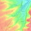
Le Petit Vimy

France > Hauts-de-France > Pas-de-Calais > Vimy

Average elevation: 305 ft

Entre Deux Chemins

France > Hauts-de-France > Pas-de-Calais > Herly

Average elevation: 558 ft

Mont Pourri

France > Hauts-de-France > Pas-de-Calais > Saint-Aubin

Average elevation: 105 ft

Gear up for your next adventure:

🧭Map Reading Tools - Tools and kits for map navigation
🌄Hiking Binoculars - Compact binoculars for scenic views and trail spotting
⛺Backpacking Tents - Weight-optimized shelters for multi-day topographic surveys
🪶Camp Gear Gift Set - Perfect gift bundle for outdoor fans
🥤Water Filter Bottle - All‑in‑one filter bottle for safe hydration

As an Amazon Associate, this site earns from qualifying purchases at no extra cost to you.