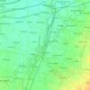
Grogol topographic map
Click on the map to display elevation.
About this map

Name: Grogol topographic map, elevation, terrain.
Location: Grogol, Kediri Regency, East Java, 64151, Indonesia (-7.79344 111.91896 -7.71344 111.99896)
Average elevation: 315 ft
Minimum elevation: 174 ft
Maximum elevation: 902 ft
Other topographic maps
Click on a map to view its topography, its elevation and its terrain.