Geolocate

Halbars topographic map

Click on the map to display elevation.

About this map

Name: Halbars topographic map, elevation, terrain.

Location: Halbars, Clohars-Carnoët, Quimper, Finistère, Bretagne, France métropolitaine, 29360, France (47.76145 -3.61327 47.80145 -3.57327)

Average elevation: 105 ft

Minimum elevation: 0 ft

Maximum elevation: 223 ft

Other topographic maps

Click on a map to view its topography, its elevation and its terrain.
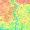
La Laïta

France > Bretagne > Finistère > Clohars-Carnoët

Average elevation: 148 ft

Gear up for your next adventure:

🔥Fast-Boil Camping Stoves - Efficient cooking systems for quick trail meals
👓Polarized Sunglasses - Outdoor sunglasses for glare reduction
🛶Inflatable Kayak - Portable kayak for rivers, lakes, and expeditions
🕶️Glacier Sunglasses - Side shields to protect eyes from high-altitude snow glare
🔊Portable Camp Speaker - Music and alerts at camp

As an Amazon Associate, this site earns from qualifying purchases at no extra cost to you.