
Adelaide River topographic map
Click on the map to display elevation.
About this map
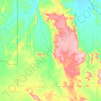
Name: Adelaide River topographic map, elevation, terrain.
Location: Adelaide River, Northern Territory, Australia (-13.51950 131.05018 -13.30623 131.10919)
Average elevation: 453 ft
Minimum elevation: 187 ft
Maximum elevation: 886 ft
Other topographic maps
Click on a map to view its topography, its elevation and its terrain.
Alice Springs
Australia > Northern Territory > Alice Springs
Temperatures in Alice Springs vary widely, and rainfall can vary quite dramatically from year to year. In summer, the average maximum temperature is in the mid-30s, whereas in winter the average minimum temperature can be 5.5 °C (41.9 °F), with an average of 12.4 nights below freezing every year, providing…
Average elevation: 2,070 ft