Geolocate

Forster topographic map

Click on the map to display elevation.

About this map

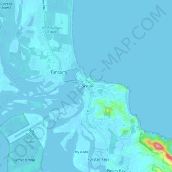
Name: Forster topographic map, elevation, terrain.

Location: Forster, Mid-Coast Council, New South Wales, Australia (-32.22209 152.47312 -32.14209 152.55312)

Average elevation: 13 ft

Minimum elevation: -13 ft

Maximum elevation: 476 ft

Gear up for your next adventure:

🧭GPS Watch Accessories - Bands and chargers for GPS watches
🕶️Glacier Sunglasses - Side shields to protect eyes from high-altitude snow glare
🔊Portable Camp Speaker - Music and alerts at camp
🪶Fire Starter Kit - Reliable fire starter for survival and camping
🧢Outdoor Hiking Hat - Sun protection hat for outdoor explorers

As an Amazon Associate, this site earns from qualifying purchases at no extra cost to you.