Geolocate

Goondiwindi topographic map

Click on the map to display elevation.

About this map

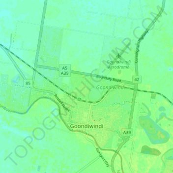
Name: Goondiwindi topographic map, elevation, terrain.

Location: Goondiwindi, Queensland, 4390, Australia (-28.55525 150.25741 -28.51165 150.32656)

Average elevation: 715 ft

Minimum elevation: 696 ft

Maximum elevation: 732 ft

Gear up for your next adventure:

📱Heavy-Duty Phone Cases - Drop-proof and waterproof protection for outdoor navigation
📌Outdoor GPS Map App - Apps and devices for digital topographic navigation
🏫Relief Map Kits - Hands-on tools for teaching landforms and elevation
🧯Emergency Survival Kit - All‑in‑one survival essentials for the backcountry
🪶LED Camping Lantern - Bright lantern for camp lighting

As an Amazon Associate, this site earns from qualifying purchases at no extra cost to you.