Geolocate

Kiagot topographic map

Click on the map to display elevation.

About this map
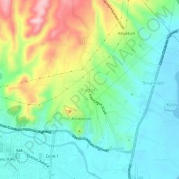
Name: Kiagot topographic map, elevation, terrain.

Location: Kiagot, Digos, Davao del Sur, Davao Region, 8002, Philippines (6.75300 125.34418 6.79300 125.38418)

Average elevation: 243 ft

Minimum elevation: 0 ft

Maximum elevation: 761 ft

Gear up for your next adventure:

📷Action Camera - Capture your outdoor adventures in HD
🪑Ultralight Camp Chairs - Portable seating for resting after a long day of mapping
🧭Orienteering Set - Complete compass and map reading kit
🔪Outdoor Multitools - Essential survival tools for gear repair and field use
🧢Sun Protection Hats - Wide-brimmed and UPF-rated hats for high-altitude sun safety

As an Amazon Associate, this site earns from qualifying purchases at no extra cost to you.