Geolocate

Teramo topographic map

Click on the map to display elevation.

About this map

Name: Teramo topographic map, elevation, terrain.

Location: Teramo, Abruzzo, 64100, Italy (42.59510 13.58228 42.71934 13.82804)

Average elevation: 1,434 ft

Minimum elevation: 331 ft

Maximum elevation: 5,581 ft

Other topographic maps

Click on a map to view its topography, its elevation and its terrain.
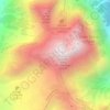
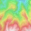
Appennino abruzzese

Italy > Abruzzo > Teramo > Pietracamela

Average elevation: 7,385 ft

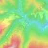
Intermesoli

Italy > Abruzzo > Teramo > Pietracamela

Average elevation: 2,913 ft

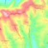
Nerito

Italy > Abruzzo > Teramo

Average elevation: 3,081 ft

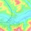
Favale

Italy > Abruzzo > Teramo > Civitella del Tronto

Average elevation: 607 ft

Marciano

Italy > Abruzzo > Teramo > Montefino

Average elevation: 850 ft

Villa Piano

Italy > Abruzzo > Teramo > Isola del Gran Sasso d'Italia

Average elevation: 1,913 ft

Villa Vomano

Italy > Abruzzo > Teramo > Teramo

Average elevation: 659 ft

Gear up for your next adventure:

🧢Outdoor Hiking Hat - Sun protection hat for outdoor explorers
🕶️Glacier Sunglasses - Side shields to protect eyes from high-altitude snow glare
⛺Backpacking Tents - Weight-optimized shelters for multi-day topographic surveys
⛺Backpacking Tent - Lightweight and durable tent for multi‑day hikes
🛶Inflatable Kayak - Portable kayak for rivers, lakes, and expeditions

As an Amazon Associate, this site earns from qualifying purchases at no extra cost to you.