Geolocate

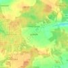
Stryków topographic map

Click on the map to display elevation.

About this map

Name: Stryków topographic map, elevation, terrain.

Location: Stryków, gmina Stryków, Zgierz County, Łódź Voivodeship, Poland (51.88334 19.58801 51.92122 19.64342)

Average elevation: 551 ft

Minimum elevation: 486 ft

Maximum elevation: 627 ft

Other topographic maps

Click on a map to view its topography, its elevation and its terrain.
Skórka

Poland > Łódź Voivodeship > Zgierz County

Average elevation: 472 ft

Jasionka

Poland > Łódź Voivodeship > Zgierz County > Jasionka

Average elevation: 492 ft

Gear up for your next adventure:

💧Water Filtration Bottles - Safely drink from streams and lakes while exploring
🪶Wildlife Field Guides - Learn animal tracking and species ID
🥘Titanium Cookware - Durable, featherlight pots and pans for backpacking
🥤Water Filter Bottle - All‑in‑one filter bottle for safe hydration
🦟Ultrasonic Repellers - Create a bug-free zone at your camp or rest stop

As an Amazon Associate, this site earns from qualifying purchases at no extra cost to you.