
Ovifat topographic map
Interactive map
Click on the map to display elevation.
About this map
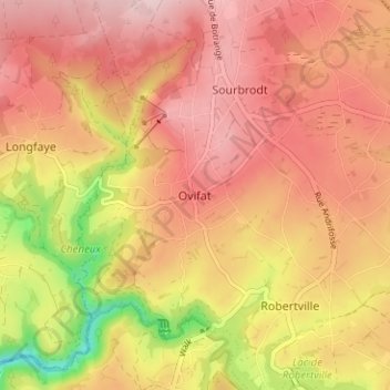
Name: Ovifat topographic map, elevation, terrain.
Average elevation: 1,781 ft
Minimum elevation: 1,293 ft
Maximum elevation: 2,054 ft
Other topographic maps
Click on a map to view its topography, its elevation and its terrain.
Burcht Reinhardstein
België > Luik > Verviers > Ovifat
Burcht Reinhardstein, Chemin du Chèneu, Ovifat, Robertville, Waimes, Verviers, Luik, Wallonië, 4950, België
Average elevation: 1,706 ft