
Make a donation
Gear up for your next adventure:
As an Amazon Associate, this site earns from qualifying purchases at no extra cost to you.
Burcht Reinhardstein topographic map
Click on the map to display elevation.
Make a donation
Gear up for your next adventure:
As an Amazon Associate, this site earns from qualifying purchases at no extra cost to you.
Burcht Reinhardstein
Reinout van Weismes heeft de hoogteburcht in 1354 gebouwd. Hij ligt op een rotsachtige uitsprong in het rivierdal en is nu helemaal omgeven door bos. Door erfenissen en huwelijken kwam hij achtereenvolgens in de handen van de families Nesselrode, Nassau, Schwartzenberg en ten slotte van 1550 tot 1812 in eigendom van de graven van Metternich, behalve tussen 1795-1798 toen de Franse revolutionaire administratie hem verbeurdverklaarde. Franz Georg Karl Graaf van Metternich-Winnenburg-Beilstein verkocht het familiedomein in 1812 aan een handelaar in bouwmaterialen.
Make a donation
Gear up for your next adventure:
As an Amazon Associate, this site earns from qualifying purchases at no extra cost to you.
About this map
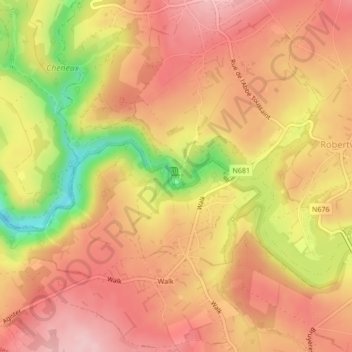
Name: Burcht Reinhardstein topographic map, elevation, terrain.
Average elevation: 1,706 ft
Minimum elevation: 1,322 ft
Maximum elevation: 1,909 ft
Make a donation
Gear up for your next adventure:
As an Amazon Associate, this site earns from qualifying purchases at no extra cost to you.