Geolocate

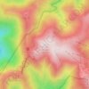
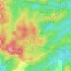
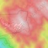
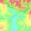
Mount Buller topographic map

Click on the map to display elevation.

Mount Buller

Due to its far south-western location in the alpine region, Mount Buller is more susceptible to cold airmasses which allow it to record some of the lowest maximum temperatures and daytime readings in the country, despite being considerably lower in elevation than other mountain sites to the north-east. On 05 September 1995, a maximum temperature of just −6.2 °C (20.8 °F) was registered at Mount Buller; the same day at Thredbo Top Station saw a maximum of −6.0 °C (21.2 °F), some 250 metres (820 ft) higher than Buller. On 03 February 2023, at the height of summer, Mount Buller reached a top of just 0.9 °C (33.6 °F).

Wikipedia (CC-BY-SA 3.0)

About this map

Name: Mount Buller topographic map, elevation, terrain.

Location: Mount Buller, Shire of Mansfield, Victoria, 3723, Australia (-37.53623 146.21169 -37.00264 146.65604)

Average elevation: 2,703 ft

Minimum elevation: 840 ft

Maximum elevation: 5,837 ft

Other topographic maps

Click on a map to view its topography, its elevation and its terrain.
Twelve Apostles

Australia > Victoria > Princetown

Average elevation: 102 ft

Melbourne

Australia > Victoria > Melbourne

Melbourne is also prone to isolated convective showers forming when a cold pool crosses the state, especially if there is considerable daytime heating. These showers are often heavy and can include hail, squalls, and significant drops in temperature, but they often pass through very quickly with a rapid…

Average elevation: 161 ft

Western Port

Australia > Victoria

Average elevation: 0 ft

Tanjil Bren

Australia > Victoria

Average elevation: 2,234 ft

Corryong

Australia > Victoria

Average elevation: 1,102 ft

Reedy Creek

Australia > Victoria

Average elevation: 466 ft

Silvan Reservoir

Australia > Victoria > Melbourne

Average elevation: 886 ft

Riddells Creek

Australia > Victoria

Average elevation: 1,339 ft

Tolmie

Australia > Victoria

Average elevation: 2,723 ft

Brimbank Park

Australia > Victoria > Melbourne

Average elevation: 171 ft

Warragul

Australia > Victoria > Warragul

Average elevation: 436 ft

Mount Hotham

Australia > Victoria > Hotham Heights

Average elevation: 5,364 ft

Koomba Park

Australia > Victoria > Melbourne

Average elevation: 315 ft

Northgateway Reserve

Australia > Victoria > Melbourne

Average elevation: 236 ft

Tarrington

Australia > Victoria

Average elevation: 755 ft

Small Waterfall

Australia > Victoria

Average elevation: 1,276 ft

Arbuckle Junction

Australia > Victoria

Average elevation: 4,596 ft

Katandra West

Australia > Victoria

Average elevation: 374 ft

Pink Lakes

Australia > Victoria

Average elevation: 164 ft

Burwood East

Australia > Victoria > Melbourne > Burwood East

Average elevation: 338 ft

Allestree

Australia > Victoria

Average elevation: 49 ft

Smyths Creek

Australia > Victoria

Average elevation: 1,362 ft

Carisbrook

Australia > Victoria

Average elevation: 659 ft

Tidal River

Australia > Victoria

Average elevation: 479 ft

Hill View

Australia > Victoria > Cardigan Village

Average elevation: 1,329 ft

Greendale

Australia > Victoria

Average elevation: 1,631 ft

Lincoln Square

Australia > Victoria > Melbourne > Carlton

Average elevation: 121 ft

Mothers Beach

Australia > Victoria > Melbourne

Average elevation: 30 ft

Goodwin Sands

Australia > Victoria > Mallacoota

Average elevation: 26 ft

Gear up for your next adventure:

🚁Photography Drones - Capture stunning aerial views of landforms and topography
🥾Hiking Shoes - Durable and comfortable shoes for trail hiking
📷Action Cameras - Rugged cameras to document your journeys across rugged terrain
🌲Outdoor Survival Books - Best books on survival skills
🪶Trail Camera - Capture wildlife on your hikes

As an Amazon Associate, this site earns from qualifying purchases at no extra cost to you.